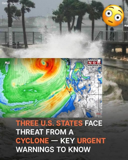
A cyclone emergency has been declared for the West Coast as a powerful storm threatens widespread damage. The National Weather Service warns of heavy rainfall, high winds, and dangerous waves as the storm undergoes bombogenesis—a rapid pressure drop of 20 to 24 millibars within 24 hours.
The storm will impact Northern California, Oregon, and Washington throughout the week. Rainfall estimates range from 8 to 12 inches, with isolated areas receiving up to 15 inches. Mountain regions are expected to see over a foot of snow, making travel through passes like Siskiyou and Snoqualmie especially hazardous.
Flooding is expected in areas with poor drainage, while wildfire-scarred regions are at risk for landslides. Rivers and streams may overflow, and unstable terrain could lead to rockfalls on mountain roads. In coastal areas, strong winds could down power lines and uproot trees, compounding the risks.
Residents are advised to secure their homes, stock emergency supplies, and stay updated on local weather reports. Avoid unnecessary travel and follow evacuation orders if issued.