Hurricane Erin, the first major storm of the Atlantic season, has weakened slightly but remains a powerful Category 4 hurricane.
The storm is currently about 395 miles east of Grand Turk Island, with winds near 140 miles per hour. Erin reached Category 5 strength late Friday before losing some intensity.
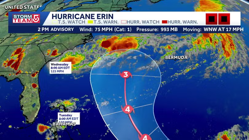
Forecasters say Erin will move west-northwest through the weekend, then curve north early next week. That track should keep it offshore from the United States, but the storm will still generate life-threatening surf and rip currents along the East Coast.
Heavy rainfall of 2 to 4 inches, with isolated totals near 6 inches, is expected across parts of the northern Caribbean. Officials warn of flash flooding and landslides in vulnerable areas.